
We dropped Lyn and Ian at the Las Vegas Airport and headed north to Utah.
We wanted to visit Zion and Bryce National Parks.
Zion National Park

We passed through the small town of Springdale, the entrance to Zion NP.

Zion was just coming into fall and the foliage started to put on its colourful display.


The road into Zion offers spectacular panoramas of the magnificent shear ridges.


If you can see the climbers it will put the size of these cliffs into perspective.


The road took us through a long tunnel and when we emerged the rock formation changed.
The rock turned into what looked like a topographical map.

We spotted a herd of Bighorn Sheep, native to the high country.


Another panoramic vista.

The second section of the park is vehicle restricted so the Rangers take you up the canyon in buses.

We disembarked at the first point to do a walk up to an area known as Emerald Pools.


We encountered a not-so-timid female Mule Deer.
Mule Deer are a common sight as we travel through the parks.

Note the walking track under the water falls.

One of the pools


Weeping Rock

Temple of Sinawava, the end of the road.
It looks snow capped but it is just white rock.

The road around Zion and southern Utah is full of surprises.

Here is the Virgin Trading Post.
The interesting little village was built by the owner.

Bryce Canyon National Park
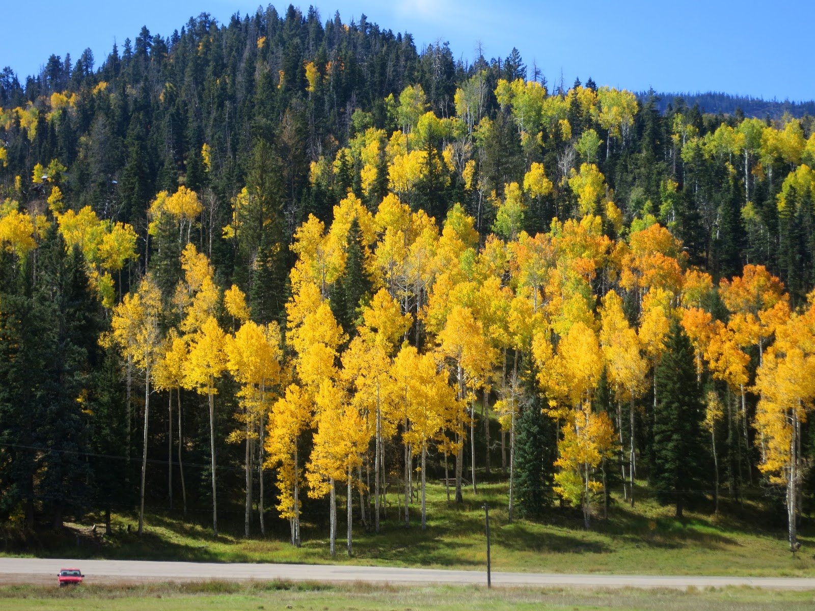
The drive up to Bryce Canyon NP took us over a high pass and through Cedar Breaks National Monument and Dixie National Forest.

Fall colours along the roadside.

Ancient lava flow in Dixie National Forest.
Very little vegetation grows in the lava flow.

We stopped for lunch close to a herd of wild Pronghorns.

A lone male Pronghorn had strategically positioned himself where he could view and guard the females.
Pronghorns are reputed to be the second fastest mammal in the world. Second to the Cheetah.
As I was creeping closer to the herd another car pulled up and stampeded the herd.
As I was creeping closer to the herd another car pulled up and stampeded the herd.

Red Rock bridge along the road.

This is the campsite at Red Rock we stopped at overnight.

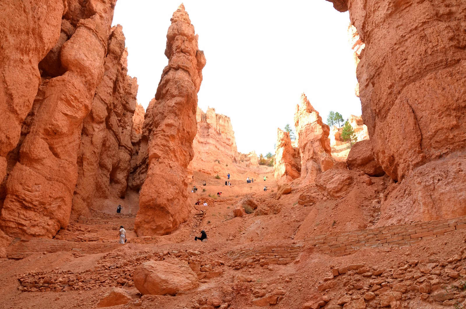
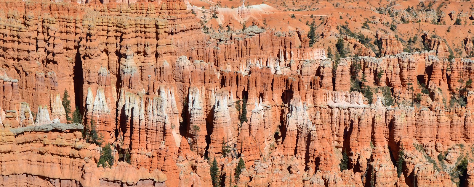
Bryce Canyon NP is up there with the most spectacular parks we have visited.
Basically the park is perched on an 20 plus mile long escarpment with an elevation of 2770 metre.
There are roads along the escarpment to view points overlooking colourful limestone rock in bizarre formations including slot canyons, windows, fins and countless spires called "hoodoos".

We set up camp and took a short trip out to Sunset Point.
The vista left us speechless.

There are numerous challenging walks that take you through the slot canyons and towering hoodoos down to the plateau below.


Ice, snow & rain over millions of years have eroded the limestone and formed these precariously balancing spires.


Chris standing on the edge.

Thors Hammer.

The switchback down the Navajo Loop.

Looking up from the plateau.

The lower trail of Navajo Loop.

A resting spot in a slot canyon.
The long walk up.


Natural Bridge.


Capitol Reef National Park

From Bryce Canyon NP we drove through Dixie National Forest to Capitol Reef NP.

The drive over the range was stunning.


The forest was changing colour as fall set in.

Not many trees on the summit.
Panorama of Capitol Reef National Park
The Waterpocket Fold defines Capitol Reef National
Park. A nearly 100-mile long warp in the Earth's crust, the Waterpocket Fold is
a classic monocline: a regional fold with one very steep side in an area of
otherwise nearly horizontal layers. A monocline is a "step-up" in the
rock layers. The rock layers on the west side of the Waterpocket Fold have been
lifted more than 7,000 feet (2,134 m) higher than the layers on the east.


 Goosenecks Overlook


Capitol Gorge

Chris in the mouth of a "rock asp"


The Castle


Chimney Rock


Piute State Park


We had pleasant overnight stop on the lake at Piute State Park. As the sun lowered in the sky it presented me with this beautiful photo op of fall colours.
No comments:
Post a Comment